The National Cycle Network South Coast Route (No2) Destined to get Even Longer!
You might imagine, after many years of campaigning about extending cycleways, ChiCycle would be excited and enthused over the prospect of a cycle route being made longer! However, we are concerned that the National Cycle Network South Coast Route (No2) is destined to become longer only by virtue of it being made increasingly convoluted. People will soon have to travel even further just to reach the same destinations. Unfortunately the section from the City’s Market Cross to the Fishbourne underpass is threatened with being diverted yet again!
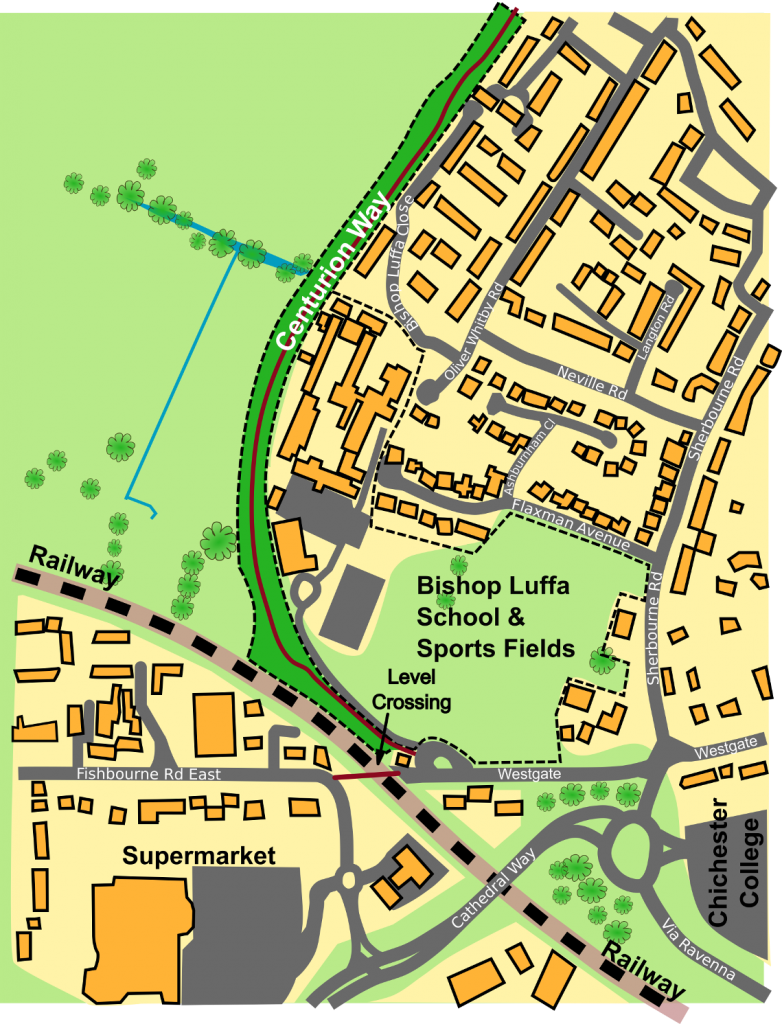
Prior to 2013, the route between the Market Cross and the Fishbourne underpass followed virtually a straight line as can be seen in the map below.
Google maps still show images from the railway level crossing arrangement.
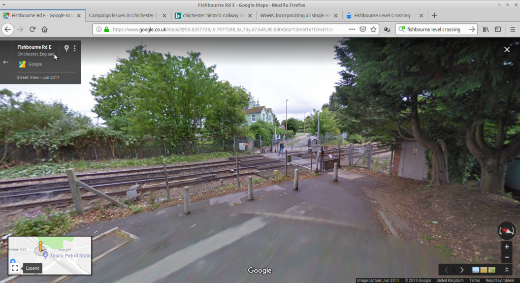
There were several accidents on the crossing and the Bishop Luffa School had safety concerns for students, so a foot bridge was erected. Unfortunately the footbridge adds approximately 225 metres distance to the journeys between the Fishbourne underpass and the Market cross. It would have been convenient if both the footbridge and the level crossing options were left open for the cycle route users to choose between. A map of the current route can be seen below.

There is often congestion on the narrow bridge when pedestrians and cyclists use the bridge at busy times of the day.
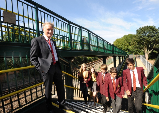
Although the bridge does provide safety from train collisions, cyclists (and anyone else using the ramps) are now required to make two huge zig zags with sharp 180º turns at each end. This considerably lengthens journey times.
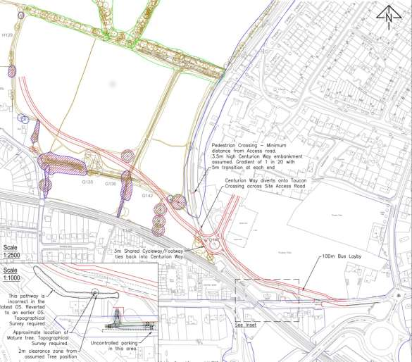
Draft plans drawn up by the White House Farm Development show a much bigger diversion is being considered. It stands to increase journey lengths by 501 metres over the original cycle route’s length (from when the route included the level crossing). This represents an increase of 276 metres above the increased length caused by the footbridge. Bearing in mind many commuters follow the route in opposite directions at the start and end of the day, this would add over one kilometre to the distance they travel each day. To put that distance into perspective, it is approximately one kilometre (as the crow flies) between the Chichester Waitrose and Tesco supermarket car parks. The map below shows the route outlined by the draft Whitehouse Farm plans.
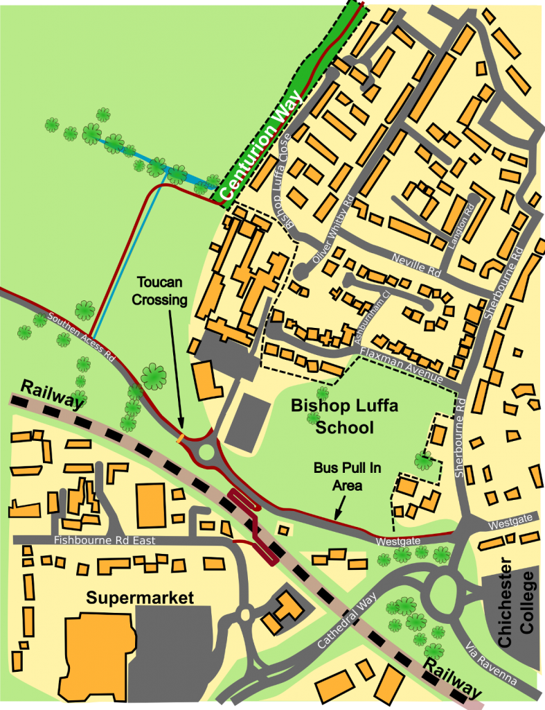
The red lines indicate the proposed cycleways. Once the bridge has been crossed coming from the Fishbourne side, there will be no path to follow directly towards the city along the south side of the new Southern Access Rd. Instead, pedestrians and cyclists will be directed North West away from the city centre. The new diversion first takes people past the south side of a new roundabout where shortly afterwards they will reach a toucan crossing. After using the toucan crossing to cross the road it will then be necessary to pass the roundabout a second time on its opposite north side (that is if cycleway users wish to travel to the city centre).
The draft plans do not make it clear how cyclists should negotiate the spur road going from the roundabout into Bishop Luffa School. Shortly after passing this entrance to Bishop Luffa School, people will find themselves passing a spot they have past for an incredible fourth time! Indeed they will have been past the spot twice in both directions on the zig zag ramp on the bridge. Then they will have also been past the same spot going in either direction on both sides of the new road. The ChiCycle team feel this may seriously dissuade people from wanting to commute. Even more concerning, it may persuade cyclists to adopt the alternative route past the Tesco petrol station. However this alternative route requires filtering across two lanes of a dual carriageway before then crossing the additional two lanes travelling in the opposite direction. This route appears a significantly less safe option.
The draft plans show a bus pull in area is situated next to the cycleway on the north side of the Southern Access Rd. It seems likely crowds of students will gather on the pavement area here. The plan does not make it clear if or how the cycle way will be separated from crowds of students using the school buses. Without separation this will cause a serious impediment to the passage of cycles along the pathway.
The Whitehouse Farm draft plan referred to here has previously been published by the Friends of Centurion Way in their Dossier. A copy of the draft plan is shown below.
2 thoughts on “The National Cycle Network South Coast Route (No2) Destined to get Even Longer!”