Have Approved Plans Already Ended the Future for Cycleways to the West of Chichester? It looks like they may have!
ChiCycle is seeking advice as to whether the “West of Chichester Strategic Housing Development Cycle Strategy for Phase 1” plans have already been approved by local government. The document includes a sketch of a new arrangement of the Sherborne Road mini roundabout. The details included in the sketch are vague but viewed in conjunction with other draft plans they show a cycle route layout that is worse (more dangerous and less practical) than no cycle provision whatsoever.
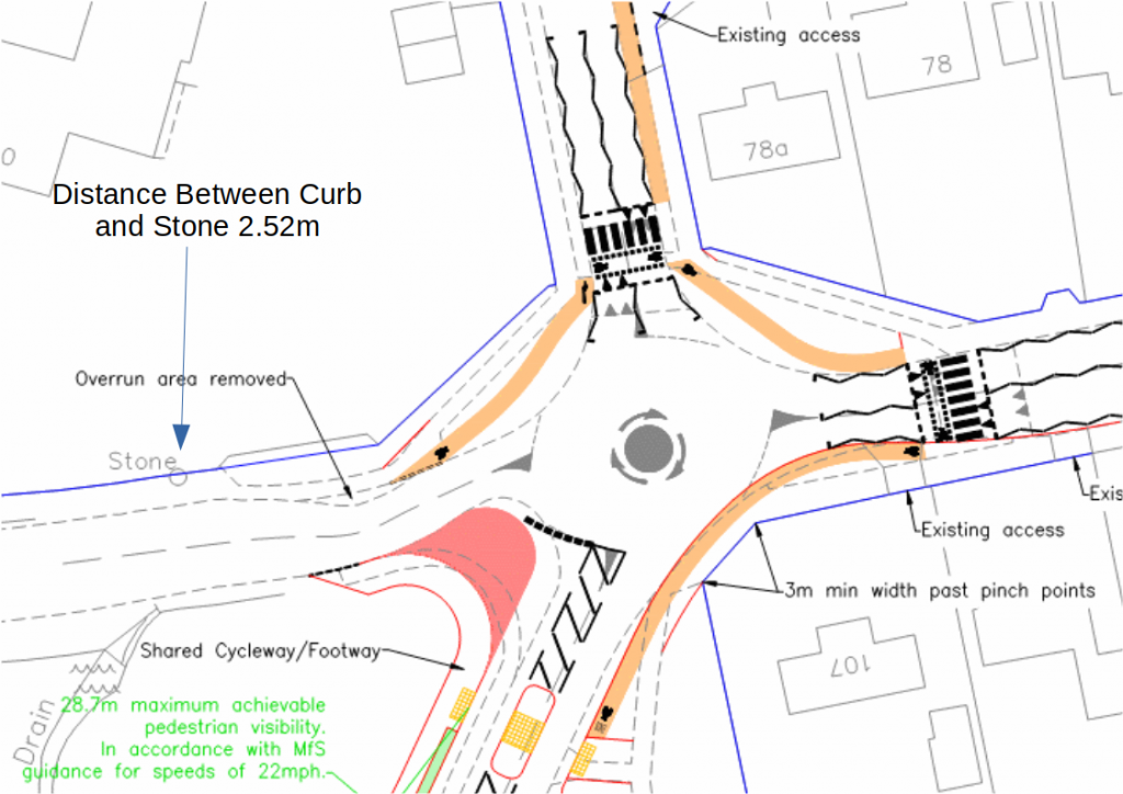
The Southern Access Rd enters the mini roundabout as shown from the left of the plan. When compared to the existing road layout the position of the kerb-stones on the road’s North side are identical to the existing roadway. In fact the road encroaches slightly closer to the Northern property boundaries where the “overrun area removed” section runs.
The distance between the Mile “Stone” marked on the sketched plan and the existing kerb-stone is only 252 cm. There is no cycle way shown running along the southern side of the access Rd on this section of the plan and indeed other draft plans show no cycleway is intended to run along the southern side of the roadway either.
According to the developers “The northern side of the spine road has principally been chosen for the shared cycle/pedestrian way as it facilitates the creation of a continuous, cycle friendly recreational route which requires no crossings of the primary access road. A subsidiary benefit is that, by being located on the northern side of the road, it facilitates easy access to the local centre, which includes the primary school, community centre and local shopping parade.”
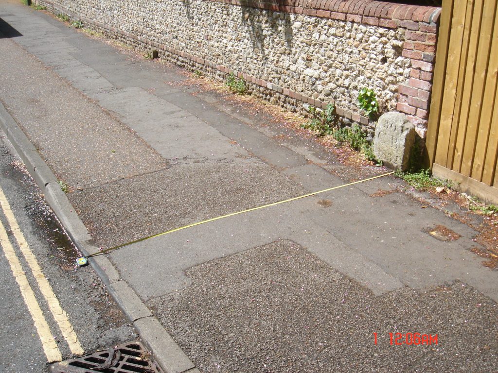
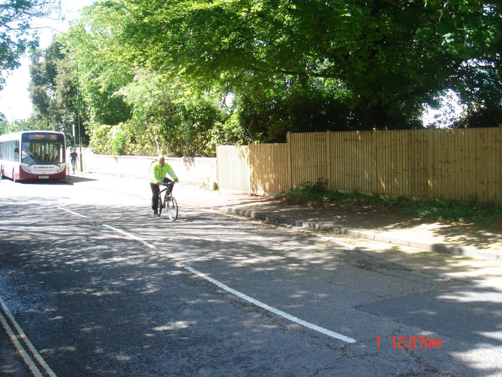
Therefore evidence suggests, the intention is to run a cycleway carrying all bike traffic (in both directions) only along the northern side of the Southern Access Road. As this traffic passes the Mile “Stone” it will be on the start of a blind curve running on a pavement width of only 252 cm. This narrow pavement will presumably be carrying the entire cycle traffic from two national cycleways, the “South Coast Route No2” and “Centurion Way Route 88”. This will also be in addition to cycle traffic from the Saltern’s Way and the residents of the new West of Chichester development who are unlikely to brave heavy traffic on the St Pauls Rd B2178 which has no plans for cycle provision.
It is important to note that this heavy two way cycle traffic, pinching onto the start of blind bend along the 252cm wide track, will also be shared with, children accessing and leaving Bishop Luffa School, parents with prams, disabled and elderly pedestrians from the new Whitehouse farm development, Fishbourne and also Centurion Way. It seems unlikely that “These features follow the principles outlined in page 21 of the Sustrans Handbook for Cycle Friendly Design (2014) and section 3.5.3 of the London Cycling Design Standards” as the Lindon Miller developers claim. It is merely a narrow pavement only running along one side of a road that is barely adequate for current pedestrian use alone.
A significant risk associated with inadequate and dangerous cycle infrastructure, is that it provides motorists with an expectation that cyclists are not entitled to use other parts of the highway. This is exemplified by cyclist experiences on the Northgate Gyratory where cyclists avoiding the poorly designed road layout regularly experience life threatening aggression from motorists. This type of aggression will eventually lead to fatalities and maiming of people adopting responsible, sustainable transport modes.
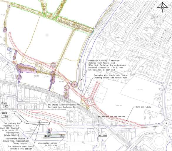
Another area of concern with the Housing Development Cycle Strategy is the indication that a short section of pavement opposite Chichester College will be considered a shared use Cycleway/Footway. The plans indicate that the visibility at the crossing pedestrian crossing is 28.7 meters. Field measurements indicate this is an overly optimistic estimate, especially when trees are in leaf. It is hard to imagine anyone would cycle this pavement because it is such a short length of path running around a blind bend. However the vulnerability of people attempting to cross onto it is a serious concern.
This post has only touched on a couple of the issues presented by the Housing Development Cycle Strategy but these all indicate that the proposed plans are both impractical and dangerous. If similar plans are put into action they will prevent practical cycling for anyone wishing to head out of Chichester to the West. The road layout will prevent residents of the new housing development adopting sustainable transport modes. The National cycleways will effectively be isolated from the city centre. It is essential that we act quickly to reverse these retrograde plans that condemn Chichester residents to a life of motorcar dependency.
One thought on “Have Approved Plans Already Ended the Future for Cycleways to the West of Chichester? It looks like they may have!”